
- Start >
- Groundwater >
- Waterlevel of upper layer >
- Isar >
- München U8 406 >
- Chart of total period

Chart of total period München U8 406
Groundwater levels of the total period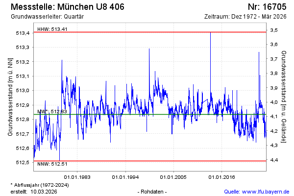
Groundwater level [m above sealevel]: 512.69
Distance to surface [m]: 4.23
Last value from 05.05.2026 09:00
Ground level [m above sealevel]: 516.92
| Date | Groundwater level [m above sealevel] |
|---|---|
| 05.05.2026 | 512.69 |
| 04.05.2026 | 512.69 |
| 03.05.2026 | 512.69 |
| 02.05.2026 | 512.69 |
| 01.05.2026 | 512.69 |
| 30.04.2026 | 512.70 |
| 29.04.2026 | 512.69 |
| 28.04.2026 | 512.69 |
© Bayerisches Landesamt für Umwelt 2026