
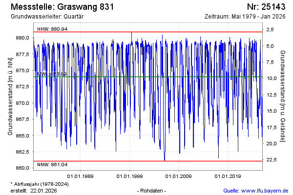
Chart of total period GRASWANG 831
Groundwater level [m above sealevel]: 868,20
Distance to surface [m]: 15,57
Last value from 23.07.2026 21:00
Ground level [m above sealevel]: 883.77
| Date | Groundwater level [m above sealevel] |
|---|---|
| 23.07.2026 | 868.15 |
| 22.07.2026 | 868.03 |
| 21.07.2026 | 867.84 |
| 20.07.2026 | 867.57 |
| 19.07.2026 | 867.30 |
| 18.07.2026 | 867.22 |
| 17.07.2026 | 867.13 |
| 16.07.2026 | 866.99 |