
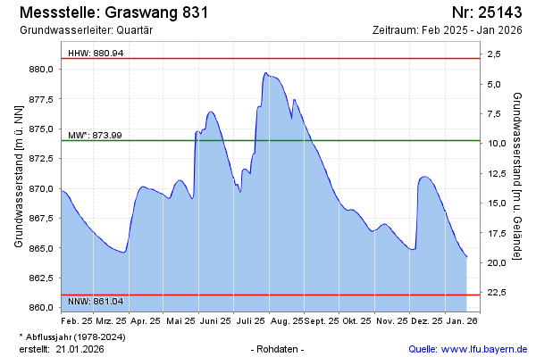
Current data GRASWANG 831
Groundwater level [m above sealevel]: 867.78
Distance to surface [m]: 15.99
Last value from 06.07.2026 21:00
Ground level [m above sealevel]: 883.77
| Date | Groundwater level [m above sealevel] |
|---|---|
| 06.07.2026 | 867.83 |
| 05.07.2026 | 867.95 |
| 04.07.2026 | 868.09 |
| 03.07.2026 | 868.25 |
| 02.07.2026 | 868.43 |
| 01.07.2026 | 868.63 |
| 30.06.2026 | 868.85 |
| 29.06.2026 | 869.07 |