
- Start >
- Groundwater >
- Waterlevel of upper layer >
- Isar >
- G29 HRB Feldolling >
- Chart of total period

Chart of total period G29 HRB Feldolling
Groundwater levels of the total period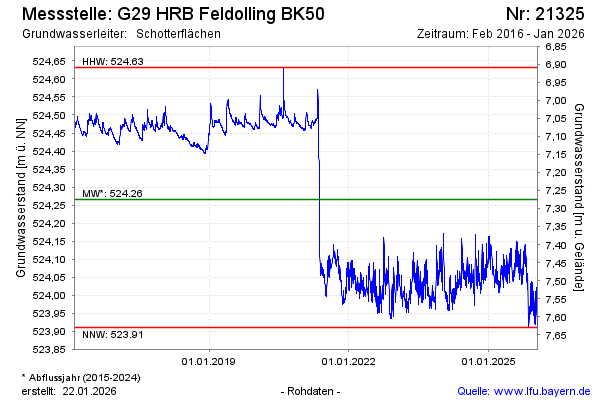
Groundwater level [m above sealevel]: 523.91
Distance to surface [m]: 7.63
Last value from 21.01.2026 10:00
Ground level [m above sealevel]: 531.54
| Date | Groundwater level [m above sealevel] |
|---|---|
| 21.01.2026 | 523.91 |
| 20.01.2026 | 523.92 |
| 19.01.2026 | 523.92 |
| 18.01.2026 | 523.93 |
| 17.01.2026 | 523.92 |
| 16.01.2026 | 523.92 |
| 15.01.2026 | 523.93 |
| 14.01.2026 | 523.93 |
© Bayerisches Landesamt für Umwelt 2026