
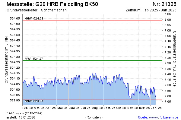
Current data G29 HRB Feldolling
Groundwater level [m above sealevel]: 523.99
Distance to surface [m]: 7.55
Last value from 13.07.2026 10:00
Ground level [m above sealevel]: 531.54
| Date | Groundwater level [m above sealevel] |
|---|---|
| 13.07.2026 | 523.98 |
| 12.07.2026 | 523.98 |
| 11.07.2026 | 523.96 |
| 10.07.2026 | 523.95 |
| 09.07.2026 | 523.95 |
| 08.07.2026 | 523.95 |
| 07.07.2026 | 523.97 |
| 06.07.2026 | 523.99 |