
- Start >
- Groundwater >
- Waterlevel of upper layer >
- Inn >
- BRUCKBERG 75.4 >
- Current data

Current data BRUCKBERG 75.4
Groundwater levels of the last 12 months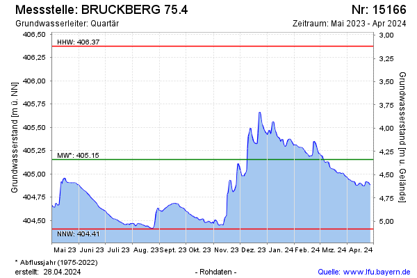
Groundwater level [m above sealevel]: 404.81
Distance to surface [m]: 4.68
Last value from 04.05.2024 10:00
Ground level [m above sealevel]: 409.49
| Date | Groundwater level [m above sealevel] |
|---|---|
| 04.05.2024 | 404.82 |
| 03.05.2024 | 404.82 |
| 02.05.2024 | 404.85 |
| 01.05.2024 | 404.85 |
| 30.04.2024 | 404.85 |
| 29.04.2024 | 404.84 |
| 28.04.2024 | 404.86 |
| 27.04.2024 | 404.87 |
© Bayerisches Landesamt für Umwelt 2024