
- Start >
- Groundwater >
- Waterlevel of upper layer >
- Inn >
- AUF DER BURG 19 >
- Year chart of precipitation

Year chart of precipitation AUF DER BURG 19
Groundwater levels of the last 12 months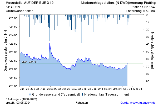
Groundwater level [m above sealevel]: 421,69
Distance to surface [m]: 22,47
Last value from 10.04.2026 07:35
Ground level [m above sealevel]: 444.16
© Bayerisches Landesamt für Umwelt 2026