
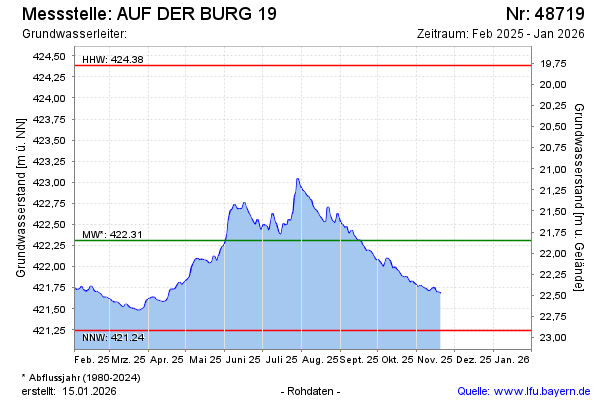
Current data AUF DER BURG 19
Groundwater level [m above sealevel]: 422.48
Distance to surface [m]: 21.68
Last value from 16.06.2026 06:41
Ground level [m above sealevel]: 444.16
| Date | Groundwater level [m above sealevel] |
|---|---|
| 16.06.2026 | 422.48 |
| 15.06.2026 | 422.49 |
| 14.06.2026 | 422.52 |
| 13.06.2026 | 422.54 |
| 12.06.2026 | 422.53 |
| 11.06.2026 | 422.51 |
| 10.06.2026 | 422.41 |
| 09.06.2026 | 422.36 |