
- Start >
- Groundwater >
- Waterlevel of upper layer >
- Iller - Lech - Bodensee >
- Waal Spitalwald B 2 >
- Chart of total period

Chart of total period Waal Spitalwald B 2
Groundwater levels of the total period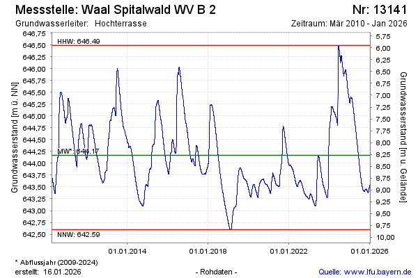
Groundwater level [m above sealevel]: 643.54
Distance to surface [m]: 8.90
Last value from 02.01.2026 10:00
Ground level [m above sealevel]: 652.44
| Date | Groundwater level [m above sealevel] |
|---|---|
| 02.01.2026 | 643.54 |
| 01.01.2026 | 643.54 |
| 31.12.2025 | 643.53 |
| 30.12.2025 | 643.53 |
| 29.12.2025 | 643.52 |
| 28.12.2025 | 643.52 |
| 27.12.2025 | 643.51 |
| 26.12.2025 | 643.51 |
© Bayerisches Landesamt für Umwelt 2026