
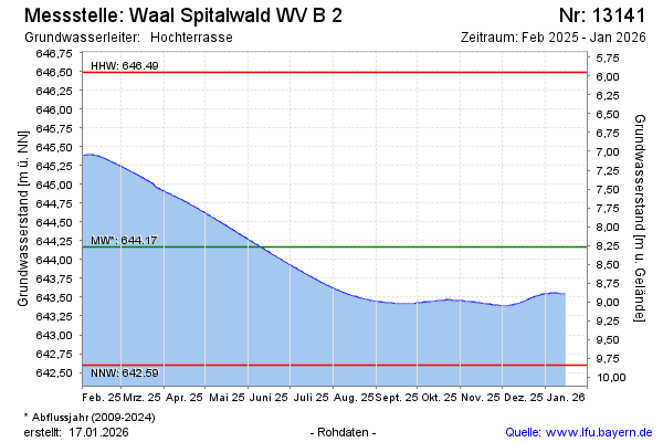
Current data Waal Spitalwald B 2
Groundwater level [m above sealevel]: 643,16
Distance to surface [m]: 9,28
Last value from 23.07.2026 10:00
Ground level [m above sealevel]: 652.44
| Date | Groundwater level [m above sealevel] |
|---|---|
| 23.07.2026 | 643.16 |
| 22.07.2026 | 643.16 |
| 21.07.2026 | 643.17 |
| 20.07.2026 | 643.17 |
| 19.07.2026 | 643.18 |
| 18.07.2026 | 643.18 |
| 17.07.2026 | 643.19 |
| 16.07.2026 | 643.19 |