
- Start >
- Groundwater >
- Waterlevel of upper layer >
- Iller - Lech - Bodensee >
- BENNINGEN D 64 >
- Chart of total period

Chart of total period BENNINGEN D 64
Groundwater levels of the total period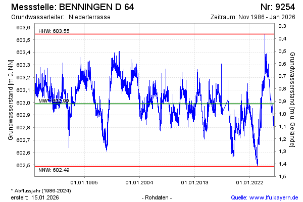
Groundwater level [m above sealevel]: 602.51
Distance to surface [m]: 1.40
Last value from 05.05.2026 07:11
Ground level [m above sealevel]: 603.91
| Date | Groundwater level [m above sealevel] |
|---|---|
| 05.05.2026 | 602.53 |
| 04.05.2026 | 602.53 |
| 03.05.2026 | 602.53 |
| 02.05.2026 | 602.53 |
| 01.05.2026 | 602.54 |
| 30.04.2026 | 602.54 |
| 29.04.2026 | 602.54 |
| 28.04.2026 | 602.55 |
© Bayerisches Landesamt für Umwelt 2026