
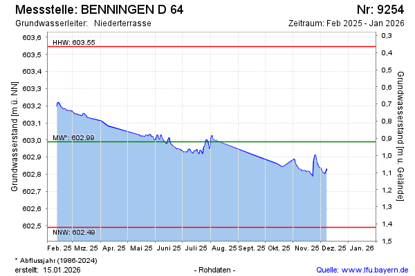
Current data BENNINGEN D 64
Groundwater level [m above sealevel]: 602.45
Distance to surface [m]: 1.4599999999999
Last value from 15.06.2026 09:28
Ground level [m above sealevel]: 603.91
| Date | Groundwater level [m above sealevel] |
|---|---|
| 02.06.2026 | 602.46 |
| 01.06.2026 | 602.47 |
| 31.05.2026 | 602.46 |
| 30.05.2026 | 602.45 |
| 29.05.2026 | 602.46 |
| 28.05.2026 | 602.46 |
| 27.05.2026 | 602.47 |
| 26.05.2026 | 602.47 |