
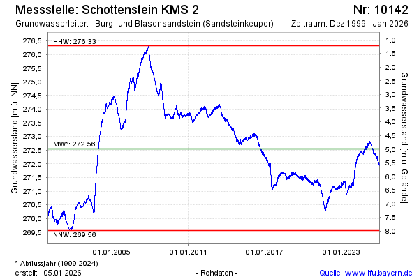
Chart of total period Schottenstein KMS 2
Groundwater level [m above sealevel]: 271.28
Distance to surface [m]: 6.26
Last value from 12.07.2026 09:36
Ground level [m above sealevel]: 277.54
| Date | Groundwater level [m above sealevel] |
|---|---|
| 12.07.2026 | 271.30 |
| 11.07.2026 | 271.31 |
| 10.07.2026 | 271.32 |
| 09.07.2026 | 271.33 |
| 08.07.2026 | 271.34 |
| 07.07.2026 | 271.35 |
| 06.07.2026 | 271.34 |
| 05.07.2026 | 271.34 |