
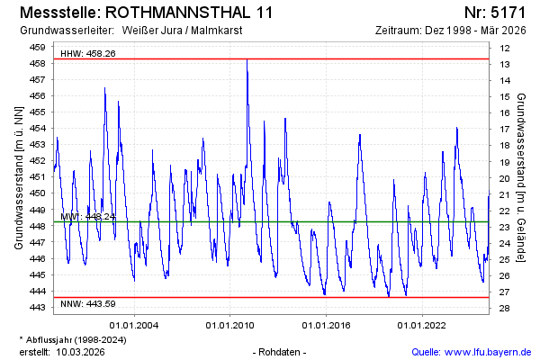
Chart of total period ROTHMANNSTHAL 11
Groundwater level [m above sealevel]: 446.60
Distance to surface [m]: 24.33
Last value from 14.07.2026 09:00
Ground level [m above sealevel]: 470.93
| Date | Groundwater level [m above sealevel] |
|---|---|
| 14.07.2026 | 446.61 |
| 13.07.2026 | 446.63 |
| 12.07.2026 | 446.67 |
| 11.07.2026 | 446.71 |
| 10.07.2026 | 446.75 |
| 09.07.2026 | 446.79 |
| 08.07.2026 | 446.83 |
| 07.07.2026 | 446.87 |