
Current data ROTHMANNSTHAL 11
Groundwater level [m above sealevel]: 447.37
Distance to surface [m]: 23.56
Last value from 24.06.2026 09:00
Ground level [m above sealevel]: 470.93
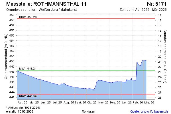
| Date | Groundwater level [m above sealevel] |
|---|---|
| 25.06.2026 | 447.37 |
| 24.06.2026 | 447.37 |
| 23.06.2026 | 447.29 |
| 22.06.2026 | 447.09 |
| 21.06.2026 | 447.07 |
| 20.06.2026 | 447.10 |
| 19.06.2026 | 447.14 |
| 18.06.2026 | 447.17 |