
Chart of total period Wassertrüdingen-Schobdach
Groundwater level [m above sealevel]: 419.93
Distance to surface [m]: 1.52
Last value from 14.07.2026 01:00
Ground level [m above sealevel]: 421.45
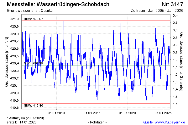
| Date | Groundwater level [m above sealevel] |
|---|---|
| 12.07.2026 | 419.92 |
| 11.07.2026 | 419.93 |
| 10.07.2026 | 419.93 |
| 09.07.2026 | 419.94 |
| 08.07.2026 | 419.94 |
| 07.07.2026 | 419.95 |
| 06.07.2026 | 419.96 |
| 05.07.2026 | 419.96 |