Year chart of precipitation Wassertrüdingen-Schobdach
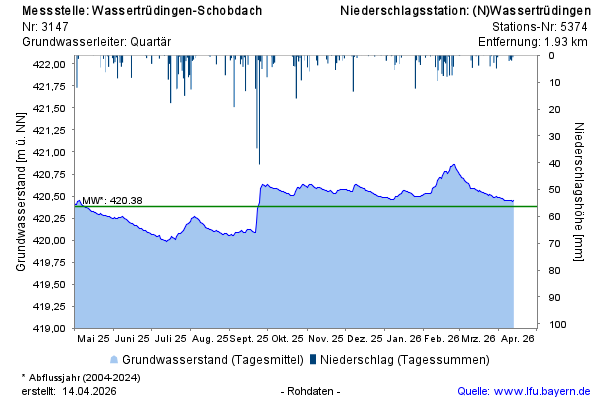
Groundwater level [m above sealevel]: 419,96
Distance to surface [m]: 1,49
Last value from 05.07.2026 01:00
Ground level [m above sealevel]: 421.45

Groundwater level [m above sealevel]: 419,96
Distance to surface [m]: 1,49
Last value from 05.07.2026 01:00
Ground level [m above sealevel]: 421.45