
- Start >
- Groundwater >
- Waterlevel of upper layer >
- Bayern >
- Tennenlohe KMS 3 >
- Chart of total period

Chart of total period Tennenlohe KMS 3
Groundwater levels of the total period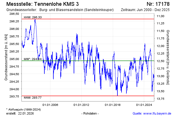
Groundwater level [m above sealevel]: 295.00
Distance to surface [m]: 12.43
Last value from 16.03.2026 09:15
Ground level [m above sealevel]: 307.43
| Date | Groundwater level [m above sealevel] |
|---|---|
| 16.03.2026 | 295.00 |
| 15.03.2026 | 295.00 |
| 14.03.2026 | 295.02 |
| 13.03.2026 | 295.01 |
| 12.03.2026 | 294.99 |
| 11.03.2026 | 295.00 |
| 10.03.2026 | 295.00 |
| 09.03.2026 | 294.99 |
© Bayerisches Landesamt für Umwelt 2026