
- Start >
- Groundwater >
- Waterlevel of upper layer >
- Bayern >
- Tennenlohe KMS 3 >
- Current data

Current data Tennenlohe KMS 3
Groundwater levels of the last 12 months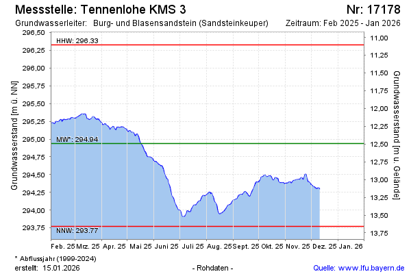
Groundwater level [m above sealevel]: 294.94
Distance to surface [m]: 12.49
Last value from 23.02.2026 09:15
Ground level [m above sealevel]: 307.43
| Date | Groundwater level [m above sealevel] |
|---|---|
| 23.02.2026 | 294.94 |
| 22.02.2026 | 294.91 |
| 21.02.2026 | 294.88 |
| 20.02.2026 | 294.86 |
| 19.02.2026 | 294.87 |
| 18.02.2026 | 294.82 |
| 17.02.2026 | 294.81 |
| 16.02.2026 | 294.80 |
© Bayerisches Landesamt für Umwelt 2026