
- Start >
- Groundwater >
- Waterlevel of upper layer >
- Bayern >
- SR/GW SPESSART 01 >
- Chart of total period

Chart of total period SR/GW SPESSART 01
Groundwater levels of the total period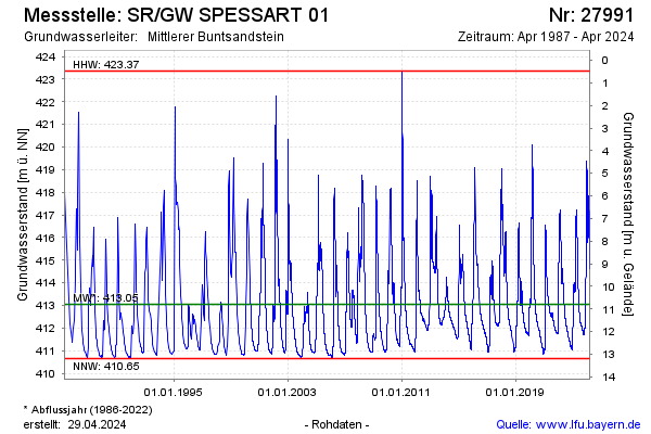
Groundwater level [m above sealevel]: 415.13
Distance to surface [m]: 8.60
Last value from 24.03.2026 12:00
Ground level [m above sealevel]: 423.73
| Date | Groundwater level [m above sealevel] |
|---|---|
| 24.03.2026 | 415.16 |
| 23.03.2026 | 415.27 |
| 22.03.2026 | 415.41 |
| 21.03.2026 | 415.55 |
| 20.03.2026 | 415.70 |
| 19.03.2026 | 415.86 |
| 18.03.2026 | 416.05 |
| 17.03.2026 | 416.25 |
© Bayerisches Landesamt für Umwelt 2026