
- Start >
- Groundwater >
- Waterlevel of upper layer >
- Bayern >
- SIMBACH B 4A >
- Year chart of precipitation

Year chart of precipitation SIMBACH B 4A
Groundwater levels of the last 12 months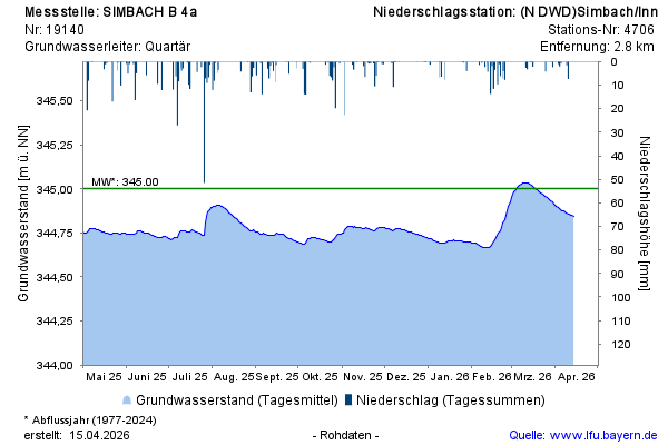
note
GW Messstelle im Grundnetz
Groundwater level [m above sealevel]: 344,85
Distance to surface [m]: 5,66
Last value from 13.04.2026 08:00
Ground level [m above sealevel]: 350.51
© Bayerisches Landesamt für Umwelt 2026