
- Start >
- Groundwater >
- Waterlevel of upper layer >
- Bayern >
- Schottenstein KMS 2 >
- Chart of total period

Chart of total period Schottenstein KMS 2
Groundwater levels of the total period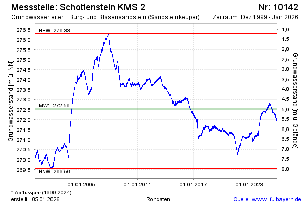
Groundwater level [m above sealevel]: 272.31
Distance to surface [m]: 5.23
Last value from 06.05.2024 10:00
Ground level [m above sealevel]: 277.54
| Date | Groundwater level [m above sealevel] |
|---|---|
| 06.05.2024 | 272.32 |
| 05.05.2024 | 272.31 |
| 04.05.2024 | 272.30 |
| 03.05.2024 | 272.31 |
| 02.05.2024 | 272.34 |
| 01.05.2024 | 272.33 |
| 30.04.2024 | 272.30 |
| 29.04.2024 | 272.29 |
© Bayerisches Landesamt für Umwelt 2024