
- Start >
- Groundwater >
- Waterlevel of upper layer >
- Bayern >
- Schottenstein KMS 2 >
- Current data

Current data Schottenstein KMS 2
Groundwater levels of the last 12 months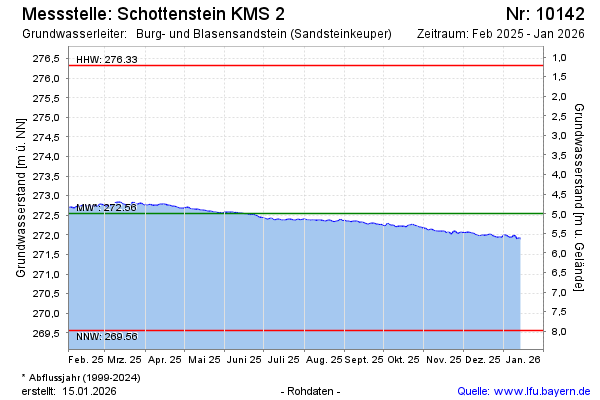
Groundwater level [m above sealevel]: 271.56
Distance to surface [m]: 5.98
Last value from 15.04.2026 09:36
Ground level [m above sealevel]: 277.54
| Date | Groundwater level [m above sealevel] |
|---|---|
| 15.04.2026 | 271.56 |
| 14.04.2026 | 271.58 |
| 13.04.2026 | 271.60 |
| 12.04.2026 | 271.59 |
| 11.04.2026 | 271.59 |
| 10.04.2026 | 271.59 |
| 09.04.2026 | 271.58 |
| 08.04.2026 | 271.57 |
© Bayerisches Landesamt für Umwelt 2026