
Chart of total period ROTHMANNSTHAL 11
Groundwater level [m above sealevel]: 446,36
Distance to surface [m]: 24,57
Last value from 22.07.2026 09:00
Ground level [m above sealevel]: 470.93
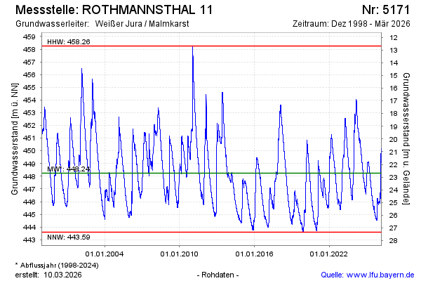
| Date | Groundwater level [m above sealevel] |
|---|---|
| 22.07.2026 | 446.36 |
| 21.07.2026 | 446.38 |
| 20.07.2026 | 446.40 |
| 19.07.2026 | 446.43 |
| 18.07.2026 | 446.46 |
| 17.07.2026 | 446.50 |
| 16.07.2026 | 446.53 |
| 15.07.2026 | 446.56 |