
- Start >
- Groundwater >
- Waterlevel of upper layer >
- Bayern >
- PERACH 626A >
- Chart of total period

Chart of total period PERACH 626A
Groundwater levels of the total period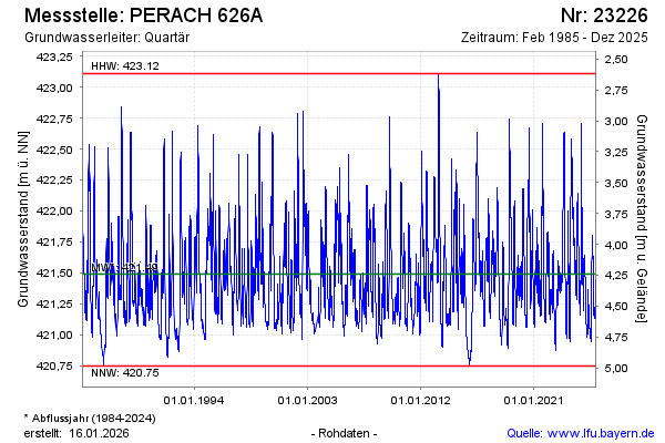
Groundwater level [m above sealevel]: 421.36
Distance to surface [m]: 4.37
Last value from 02.04.2026 07:00
Ground level [m above sealevel]: 425.73
| Date | Groundwater level [m above sealevel] |
|---|---|
| 02.04.2026 | 421.36 |
| 01.04.2026 | 421.38 |
| 31.03.2026 | 421.40 |
| 30.03.2026 | 421.42 |
| 29.03.2026 | 421.45 |
| 28.03.2026 | 421.47 |
| 27.03.2026 | 421.49 |
| 26.03.2026 | 421.52 |
© Bayerisches Landesamt für Umwelt 2026