
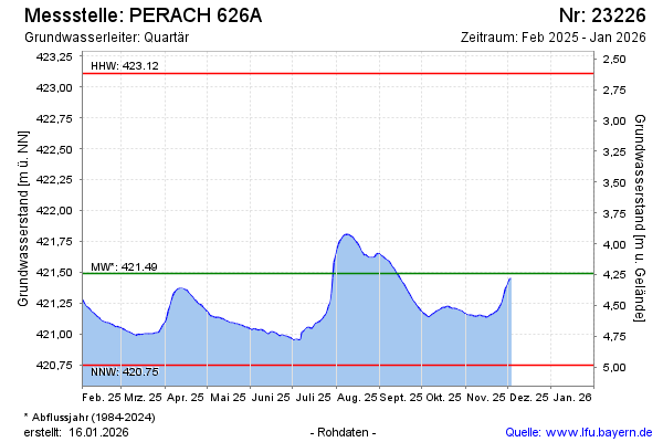
Current data PERACH 626A
Groundwater level [m above sealevel]: 420,83
Distance to surface [m]: 4,90
Last value from 07.07.2026 07:00
Ground level [m above sealevel]: 425.73
| Date | Groundwater level [m above sealevel] |
|---|---|
| 07.07.2026 | 420.83 |
| 06.07.2026 | 420.84 |
| 05.07.2026 | 420.83 |
| 04.07.2026 | 420.84 |
| 03.07.2026 | 420.84 |
| 02.07.2026 | 420.84 |
| 01.07.2026 | 420.84 |
| 30.06.2026 | 420.82 |