
Chart of total period NIKOLAKIRCHE 21A
Groundwater level [m above sealevel]: 386,85
Distance to surface [m]: 3,68
Last value from 22.07.2026 10:00
Ground level [m above sealevel]: 390.53
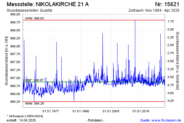
| Date | Groundwater level [m above sealevel] |
|---|---|
| 22.07.2026 | 386.85 |
| 21.07.2026 | 386.85 |
| 20.07.2026 | 386.86 |
| 19.07.2026 | 386.86 |
| 18.07.2026 | 386.84 |
| 17.07.2026 | 386.84 |
| 16.07.2026 | 386.84 |
| 15.07.2026 | 386.83 |