Year chart of precipitation NIKOLAKIRCHE 21A
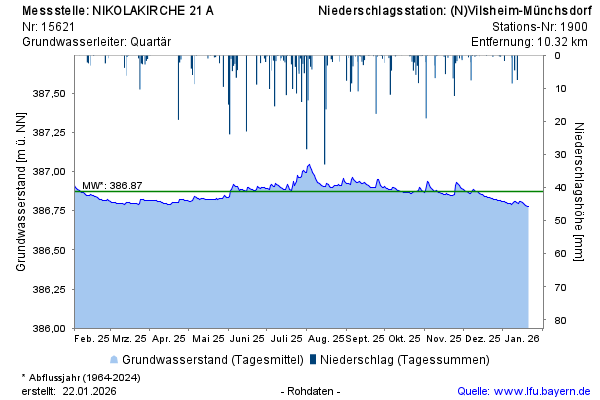
Groundwater level [m above sealevel]: 386,84
Distance to surface [m]: 3,69
Last value from 23.07.2026 10:00
Ground level [m above sealevel]: 390.53

Groundwater level [m above sealevel]: 386,84
Distance to surface [m]: 3,69
Last value from 23.07.2026 10:00
Ground level [m above sealevel]: 390.53