
- Start >
- Groundwater >
- Waterlevel of upper layer >
- Bayern >
- Niederschönenfeld 109B >
- Current data

Current data Niederschönenfeld 109B
Groundwater levels of the last 12 months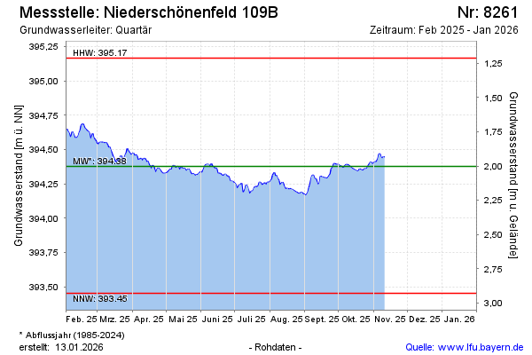
Groundwater level [m above sealevel]: 394.47
Distance to surface [m]: 1.91
Last value from 01.05.2024 07:00
Ground level [m above sealevel]: 396.38
| Date | Groundwater level [m above sealevel] |
|---|---|
| 01.05.2024 | 394.47 |
| 30.04.2024 | 394.46 |
| 29.04.2024 | 394.44 |
| 28.04.2024 | 394.45 |
| 27.04.2024 | 394.47 |
| 26.04.2024 | 394.49 |
| 25.04.2024 | 394.50 |
| 24.04.2024 | 394.51 |
© Bayerisches Landesamt für Umwelt 2024