
- Start >
- Groundwater >
- Waterlevel of upper layer >
- Bayern >
- NIEDERPOERING B 96 >
- Chart of total period

Chart of total period NIEDERPOERING B 96
Groundwater levels of the total period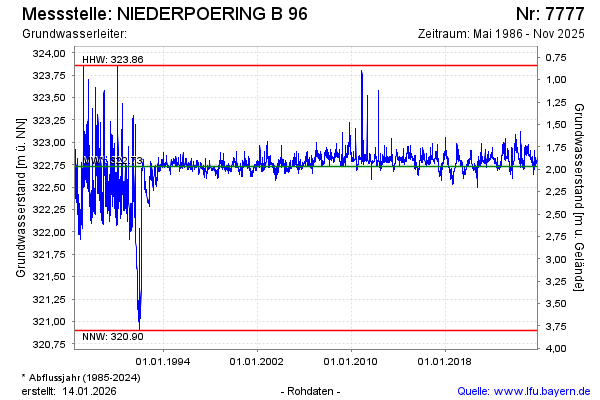
Groundwater level [m above sealevel]: 322.86
Distance to surface [m]: 1.84
Last value from 13.03.2026 11:40
Ground level [m above sealevel]: 324.70
| Date | Groundwater level [m above sealevel] |
|---|---|
| 13.03.2026 | 322.86 |
| 12.03.2026 | 322.85 |
| 11.03.2026 | 322.85 |
| 10.03.2026 | 322.85 |
| 09.03.2026 | 322.86 |
| 08.03.2026 | 322.86 |
| 07.03.2026 | 322.86 |
| 06.03.2026 | 322.87 |
© Bayerisches Landesamt für Umwelt 2026