
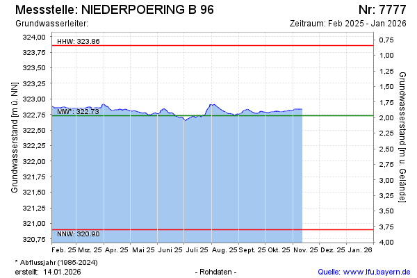
Current data NIEDERPOERING B 96
Groundwater level [m above sealevel]: 322.65
Distance to surface [m]: 2.05
Last value from 25.06.2026 13:40
Ground level [m above sealevel]: 324.70
| Date | Groundwater level [m above sealevel] |
|---|---|
| 13.03.2026 | 322.86 |
| 12.03.2026 | 322.85 |
| 11.03.2026 | 322.85 |
| 10.03.2026 | 322.85 |
| 09.03.2026 | 322.86 |
| 08.03.2026 | 322.86 |
| 07.03.2026 | 322.86 |
| 06.03.2026 | 322.87 |