
- Start >
- Groundwater >
- Waterlevel of upper layer >
- Bayern >
- Mühlfeld Mu11 >
- Master data

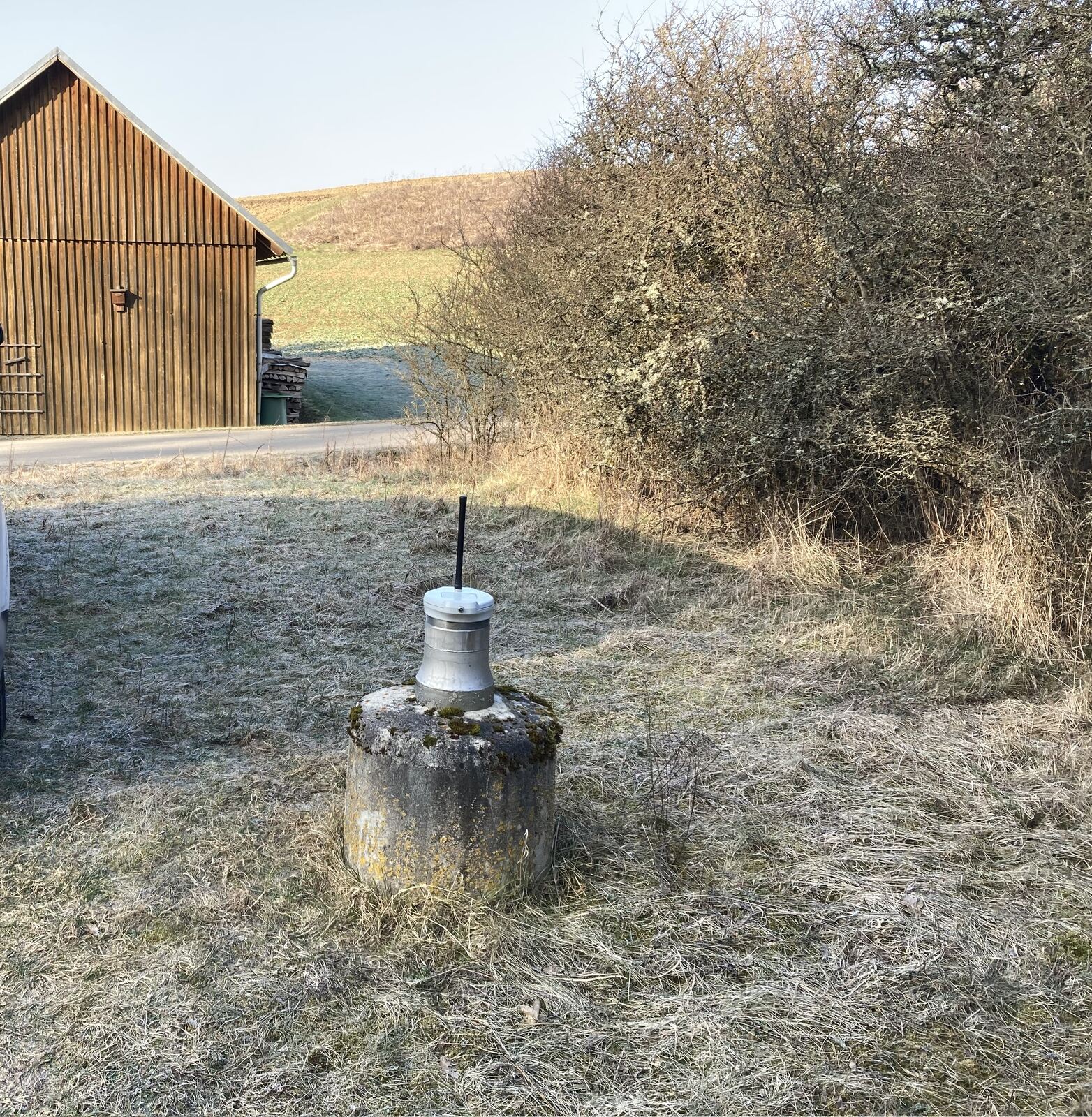
Master data Mühlfeld Mu11
Site number: 22152
Measuring point system: Grundnetz
Community: Mellrichstadt
District: Rhön-Grabfeld
Operator:  Wasserwirtschaftsamt Bad Kissingen
Aquifer: Mittlerer Muschelkalk
Measurement site depth under ground: 80.00 m
Ground level: 304.01 m above sealevel
Easting: 594938 (ETRS89 / UTM Zone 32N)
Northing: 5589390
Observation period: 20.01.2010 to 21.05.2026
Hauptwerte (Tagesmittelwerte):
Maximum waterlevel (HHW): 297.56 m above sealevel
Mean waterlevel (MW): 285.90 m above sealevel
Minimum waterlevel (NNW): 273.55 m above sealevel
Mean Highest Groundwater Level (MHGW): 291.58 m above sealevel (Period: 01.11.2009 - 01.11.2026)
Picture of the measurement site
Location of the station Mühlfeld Mu11
| Measurement site | Category |
|---|---|
 Bad Königshofen im Grabfeld Bad Königshofen im Grabfeld | Rivers: Runoff, Waterlevel |
| Salz | Rivers: Runoff, Waterlevel, Water temperature, Water temperature |
| Gollmuthhausen | Rivers: Runoff, Waterlevel |
| Nordheim vor der Rhön | Rivers: Runoff, Waterlevel |
| Unsleben | Rivers: Runoff, Waterlevel, Water temperature, Water temperature |
| Stockheim | Rivers: Runoff, Waterlevel |
| Wechterswinkel | Rivers: Runoff, Waterlevel |
| Schweinhof | Rivers: Runoff, Waterlevel |
| Poppenlauer | Rivers: Runoff, Waterlevel |
| Münnerstadt | Rivers: Runoff, Waterlevel, Water temperature, Water temperature |
| Heustreu, oh. Mdg. Streu | Rivers: Chemistry |
| Oberstreu | Rivers: Chemistry, Biology |
| Niederlauer, Renaturierung | Rivers: Chemistry, Biology |
| Heustreu, oh Strbr OE | Rivers: Chemistry, Biology |
| Bad Neustadt, vor Mdg. | Rivers: Chemistry |
| Riedmühle, uh | Rivers: Chemistry, Biology |
| Mündung ooh, Strbr | Rivers: Chemistry, Biology |
| Wechterswinkel, Pegel | Rivers: Chemistry, Biology |
| Salz, Brücke | Rivers: Chemistry, Biology |
| Brandmühle, uh | Rivers: Chemistry, Biology |
| Weidachsmühle, oh | Rivers: Chemistry, Biology |
| 01-NES - Unsleben | Rivers: Chemistry |
| uh. Wechterswinkel, Pegel | Rivers: Chemistry |
| Stockheim, Pegel | Rivers: Chemistry |
| 05-NES - Waltershausen | Rivers: Chemistry |
| 06-NES - Saal a. d. Saale | Rivers: Chemistry |
| 08-NES - Obereßfeld | Rivers: Chemistry |
| Schweinhof, Pegel | Rivers: Chemistry |
| 07-WB - Niederlauer | Rivers: Chemistry |
| Roth, oh | Rivers: Chemistry, Biology |
| Saal a.d. Saale, oh Steg | Rivers: Chemistry, Biology |
| oh. Kreuzmühle | Rivers: Chemistry, Biology |
| Nüdlingen, uh. letzter RÜ KA | Rivers: Chemistry, Biology |
| Bad Königshofen | Rivers: Chemistry |
| 09-WB - Poppenlauer | Rivers: Chemistry |
| Saal a.d. Saale, Br | Rivers: Biology |
| Münnerstadt, HWF | Rivers: Biology |
| Obereßfeld, oa | Rivers: Biology |
| Kleineibstadt, ooh | Rivers: Biology |
| Stetten S1 | Groundwater: Upper groundwater layer |
| Eichenhausen Mu10 | Groundwater: Deep groundwater layer |
| Willmars BO A | Groundwater: Deep groundwater layer |
| Salzloch 3/2 | Groundwater: Flow of well, Temperature of springs |
| Unterelsbach S3 | Groundwater: Upper groundwater layer |
| Mühlfeld Mu11 | Groundwater: Upper groundwater layer |
| Großeibstadt Mu 12 | Groundwater: Deep groundwater layer |
| Massbach MST 1 | Groundwater: Deep groundwater layer |
| Wegfurt N | Groundwater: Upper groundwater layer |
| Alsleben k 1 | Groundwater: Upper groundwater layer |
| Großbardorf kmM 1 | Groundwater: Upper groundwater layer |
| Waltershausen Q 1 | Groundwater: Upper groundwater layer |
| Theinfeld (tief) kmM 1 | Groundwater: Upper groundwater layer |
| Herbstadt kmM 1 | Groundwater: Upper groundwater layer |
| Brendlorenzen Q 1 | Groundwater: Upper groundwater layer |
| Sondheim v.d. Rhön mo 1 | Groundwater: Upper groundwater layer |
| Oberstreu mm 1 | Groundwater: Upper groundwater layer |
| 1131552700024 | Groundwater: Chemistry |
| 1132572800026 | Groundwater: Chemistry |
| 1132572900023 | Groundwater: Chemistry |
| 4110552600003 | Groundwater: Chemistry |
| 4110562700005 | Groundwater: Chemistry |
| 4110562700010 | Groundwater: Chemistry |
| 4110562800012 | Groundwater: Chemistry |
| 4110562800017 | Groundwater: Chemistry |
| 4110572700008 | Groundwater: Chemistry |
| 4120562700037 | Groundwater: Chemistry |
| 4120562800020 | Groundwater: Chemistry |
| 1131572700040 | Groundwater: Chemistry |
| 4120572700021 | Groundwater: Chemistry |
| 4120552600036 | Groundwater: Chemistry |
| 4120552700019 | Groundwater: Chemistry |
| 4120572700022 | Groundwater: Chemistry |
| 1131572700100 | Groundwater: Chemistry |
| 4120542600015 | Groundwater: Chemistry |
| 1132572600086 | Groundwater: Chemistry |
| 1132572600087 | Groundwater: Chemistry |
| 1131572800072 | Groundwater: Chemistry |
| 1131562800085 | Groundwater: Chemistry |
| 1131552600140 | Groundwater: Chemistry |
| 1131572800073 | Groundwater: Chemistry |
| 1131562900017 | Groundwater: Chemistry |
| 1131562800086 | Groundwater: Chemistry |
| 1131562800087 | Groundwater: Chemistry |
| 1131562900018 | Groundwater: Chemistry |
| Neustadt, Bad | Meteorology: Precipitation, Snow |
| Hohenroth | Meteorology: Precipitation, Wind, Air temperatur, Air moisture, Global radiation |
| Maria-Bildh | Meteorology: Precipitation, Wind, Air temperatur, Air moisture, Global radiation |
| Fladungen-Leubach | Meteorology: Precipitation, Snow, Air temperatur, Air moisture |