
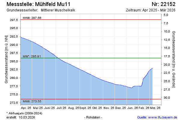
Current data Mühlfeld Mu11
Groundwater level [m above sealevel]: 282.70
Distance to surface [m]: 21.31
Last value from 13.07.2026 10:00
Ground level [m above sealevel]: 304.01
| Date | Groundwater level [m above sealevel] |
|---|---|
| 13.07.2026 | 282.73 |
| 12.07.2026 | 282.78 |
| 11.07.2026 | 282.87 |
| 10.07.2026 | 282.95 |
| 09.07.2026 | 283.03 |
| 08.07.2026 | 283.11 |
| 07.07.2026 | 283.19 |
| 06.07.2026 | 283.26 |