
- Start >
- Groundwater >
- Waterlevel of upper layer >
- Bayern >
- LIMMERSDORFER FORST-kms2 >
- Chart of total period

Chart of total period LIMMERSDORFER FORST-kms2
Groundwater levels of the total period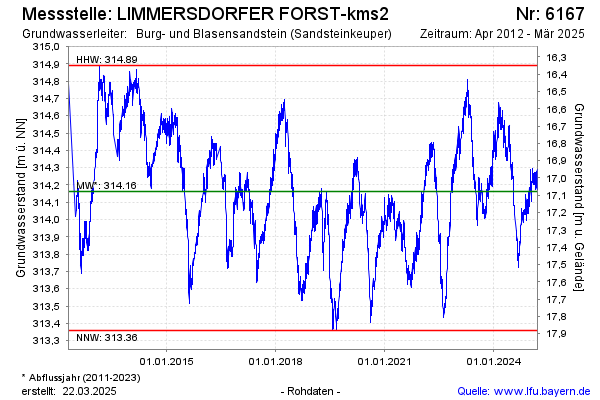
Groundwater level [m above sealevel]: 314.60
Distance to surface [m]: 16.64
Last value from 12.04.2026 09:00
Ground level [m above sealevel]: 331.24
| Date | Groundwater level [m above sealevel] |
|---|---|
| 12.04.2026 | 314.61 |
| 11.04.2026 | 314.58 |
| 10.04.2026 | 314.55 |
| 09.04.2026 | 314.52 |
| 08.04.2026 | 314.53 |
| 07.04.2026 | 314.55 |
| 06.04.2026 | 314.53 |
| 05.04.2026 | 314.54 |
© Bayerisches Landesamt für Umwelt 2026