
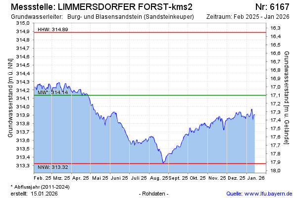
Current data LIMMERSDORFER FORST-kms2
Groundwater level [m above sealevel]: 313.62
Distance to surface [m]: 17.62
Last value from 12.07.2026 09:00
Ground level [m above sealevel]: 331.24
| Date | Groundwater level [m above sealevel] |
|---|---|
| 12.07.2026 | 313.63 |
| 11.07.2026 | 313.66 |
| 10.07.2026 | 313.68 |
| 09.07.2026 | 313.71 |
| 08.07.2026 | 313.74 |
| 07.07.2026 | 313.75 |
| 06.07.2026 | 313.76 |
| 05.07.2026 | 313.74 |