
- Start >
- Groundwater >
- Waterlevel of upper layer >
- Bayern >
- LENGGRIES-VORDERR.986 >
- Chart of total period

Chart of total period LENGGRIES-VORDERR.986
Groundwater levels of the total period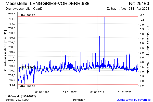
Groundwater level [m above sealevel]: 756.16
Distance to surface [m]: 4.74
Last value from 15.04.2026 05:00
Ground level [m above sealevel]: 760.90
| Date | Groundwater level [m above sealevel] |
|---|---|
| 14.04.2026 | 755.96 |
| 13.04.2026 | 756.22 |
| 12.04.2026 | 756.25 |
| 11.04.2026 | 756.28 |
| 10.04.2026 | 756.27 |
| 09.04.2026 | 756.30 |
| 08.04.2026 | 756.34 |
| 07.04.2026 | 756.36 |
© Bayerisches Landesamt für Umwelt 2026