
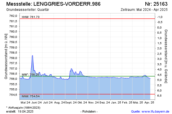
Current data LENGGRIES-VORDERR.986
Groundwater level [m above sealevel]: 755.85
Distance to surface [m]: 5.05
Last value from 15.07.2026 05:00
Ground level [m above sealevel]: 760.90
| Date | Groundwater level [m above sealevel] |
|---|---|
| 14.07.2026 | 755.85 |
| 13.07.2026 | 755.85 |
| 12.07.2026 | 755.85 |
| 11.07.2026 | 755.86 |
| 10.07.2026 | 755.86 |
| 09.07.2026 | 755.87 |
| 08.07.2026 | 755.87 |
| 07.07.2026 | 755.88 |