
- Start >
- Groundwater >
- Waterlevel of upper layer >
- Bayern >
- LAUCHDORF 560 >
- Current data

Current data LAUCHDORF 560
Groundwater levels of the last 12 months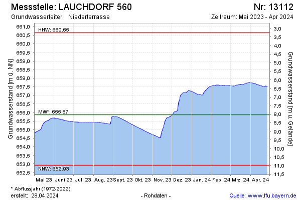
Groundwater level [m above sealevel]: 657.42
Distance to surface [m]: 6.48
Last value from 05.05.2024 00:00
Ground level [m above sealevel]: 663.90
| Date | Groundwater level [m above sealevel] |
|---|---|
| 03.05.2024 | 657.45 |
| 02.05.2024 | 657.47 |
| 01.05.2024 | 657.48 |
| 30.04.2024 | 657.49 |
| 29.04.2024 | 657.50 |
| 28.04.2024 | 657.51 |
| 27.04.2024 | 657.51 |
| 26.04.2024 | 657.52 |
© Bayerisches Landesamt für Umwelt 2024