
- Start >
- Groundwater >
- Waterlevel of upper layer >
- Bayern >
- LAUCHDORF 560 >
- Current data

Current data LAUCHDORF 560
Groundwater levels of the last 12 months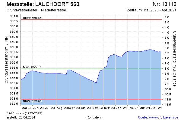
Groundwater level [m above sealevel]: 654.62
Distance to surface [m]: 9.28
Last value from 14.04.2026 04:00
Ground level [m above sealevel]: 663.90
| Date | Groundwater level [m above sealevel] |
|---|---|
| 13.04.2026 | 654.63 |
| 12.04.2026 | 654.64 |
| 11.04.2026 | 654.65 |
| 10.04.2026 | 654.65 |
| 09.04.2026 | 654.66 |
| 08.04.2026 | 654.68 |
| 07.04.2026 | 654.68 |
| 06.04.2026 | 654.69 |
© Bayerisches Landesamt für Umwelt 2026