
- Start >
- Groundwater >
- Waterlevel of upper layer >
- Bayern >
- Klosterlangheim 19 >
- Chart of total period

Chart of total period Klosterlangheim 19
Groundwater levels of the total period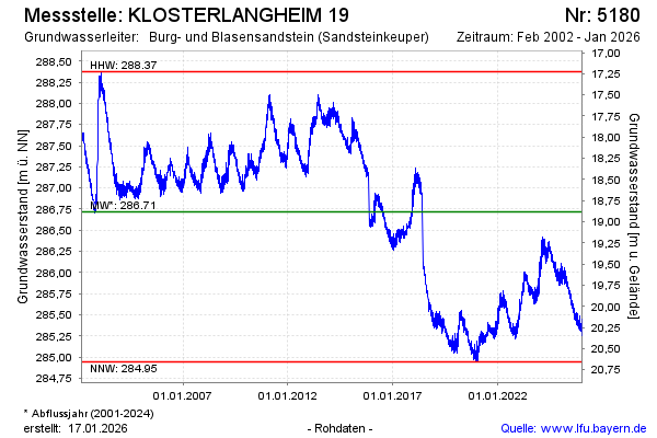
Groundwater level [m above sealevel]: 285.38
Distance to surface [m]: 20.22
Last value from 14.04.2026 10:00
Ground level [m above sealevel]: 305.60
| Date | Groundwater level [m above sealevel] |
|---|---|
| 14.04.2026 | 285.41 |
| 13.04.2026 | 285.43 |
| 12.04.2026 | 285.42 |
| 11.04.2026 | 285.42 |
| 10.04.2026 | 285.43 |
| 09.04.2026 | 285.41 |
| 08.04.2026 | 285.37 |
| 07.04.2026 | 285.37 |
© Bayerisches Landesamt für Umwelt 2026