
- Start >
- Groundwater >
- Waterlevel of upper layer >
- Bayern >
- Kalkofen 3A >
- Chart of total period

Chart of total period Kalkofen 3A
Groundwater levels of the total period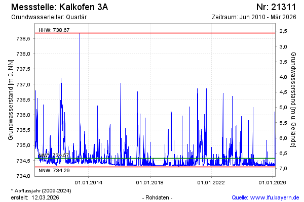
Groundwater level [m above sealevel]: 734.34
Distance to surface [m]: 6.90
Last value from 01.04.2026 14:44
Ground level [m above sealevel]: 741.24
| Date | Groundwater level [m above sealevel] |
|---|---|
| 01.04.2026 | 734.35 |
| 31.03.2026 | 734.35 |
| 30.03.2026 | 734.34 |
| 29.03.2026 | 734.33 |
| 28.03.2026 | 734.33 |
| 27.03.2026 | 734.33 |
| 26.03.2026 | 734.39 |
| 25.03.2026 | 734.38 |
© Bayerisches Landesamt für Umwelt 2026