Year chart of precipitation Kalkofen 3A
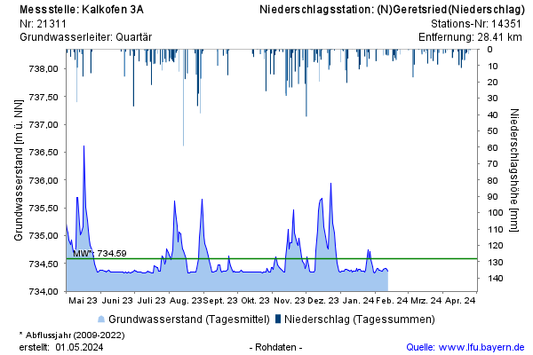
Groundwater level [m above sealevel]: 734,34
Distance to surface [m]: 6,90
Last value from 07.07.2026 13:01
Ground level [m above sealevel]: 741.24

Groundwater level [m above sealevel]: 734,34
Distance to surface [m]: 6,90
Last value from 07.07.2026 13:01
Ground level [m above sealevel]: 741.24