
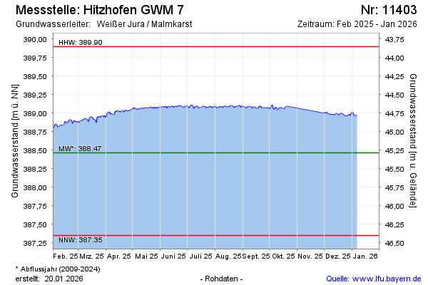
Current data Hitzhofen GWM 7
Groundwater level [m above sealevel]: 388,81
Distance to surface [m]: 44,94
Last value from 19.06.2026 08:00
Ground level [m above sealevel]: 433.75
| Date | Groundwater level [m above sealevel] |
|---|---|
| 19.06.2026 | 388.82 |
| 18.06.2026 | 388.82 |
| 17.06.2026 | 388.81 |
| 16.06.2026 | 388.82 |
| 15.06.2026 | 388.82 |
| 14.06.2026 | 388.83 |
| 13.06.2026 | 388.84 |
| 12.06.2026 | 388.82 |