
- Start >
- Groundwater >
- Waterlevel of upper layer >
- Bayern >
- Hallbergmoos >
- Current data

Current data Hallbergmoos
Groundwater levels of the last 12 months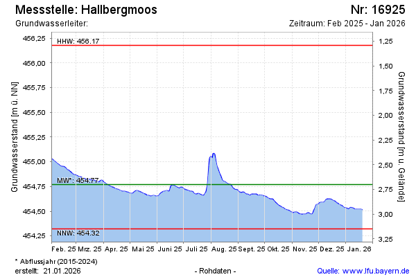
Groundwater level [m above sealevel]: 454.90
Distance to surface [m]: 2.57
Last value from 05.03.2026 09:00
Ground level [m above sealevel]: 457.47
| Date | Groundwater level [m above sealevel] |
|---|---|
| 05.03.2026 | 454.90 |
| 04.03.2026 | 454.91 |
| 03.03.2026 | 454.93 |
| 02.03.2026 | 454.95 |
| 01.03.2026 | 454.98 |
| 28.02.2026 | 455.03 |
| 27.02.2026 | 455.04 |
| 26.02.2026 | 454.98 |
© Bayerisches Landesamt für Umwelt 2026