
- Start >
- Groundwater >
- Waterlevel of upper layer >
- Bayern >
- Gangkofen B 4 >
- Current data

Current data Gangkofen B 4
Groundwater levels of the last 12 months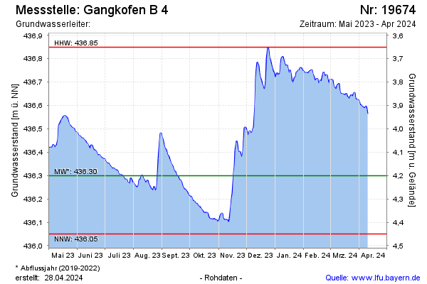
Groundwater level [m above sealevel]: 436.56
Distance to surface [m]: 3.94
Last value from 10.04.2024 13:42
Ground level [m above sealevel]: 440.50
| Date | Groundwater level [m above sealevel] |
|---|---|
| 10.04.2024 | 436.56 |
| 09.04.2024 | 436.58 |
| 08.04.2024 | 436.60 |
| 07.04.2024 | 436.59 |
| 06.04.2024 | 436.59 |
| 05.04.2024 | 436.59 |
| 04.04.2024 | 436.60 |
| 03.04.2024 | 436.60 |
© Bayerisches Landesamt für Umwelt 2024