
- Start >
- Groundwater >
- Waterlevel of upper layer >
- Bayern >
- Gangkofen B 4 >
- Current data

Current data Gangkofen B 4
Groundwater levels of the last 12 months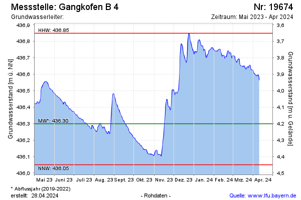
Groundwater level [m above sealevel]: 436.44
Distance to surface [m]: 4.06
Last value from 19.08.2025 12:33
Ground level [m above sealevel]: 440.50
| Date | Groundwater level [m above sealevel] |
|---|---|
| 19.08.2025 | 436.43 |
| 18.08.2025 | 436.44 |
| 17.08.2025 | 436.45 |
| 16.08.2025 | 436.47 |
| 15.08.2025 | 436.46 |
| 14.08.2025 | 436.47 |
| 13.08.2025 | 436.48 |
| 12.08.2025 | 436.50 |
© Bayerisches Landesamt für Umwelt 2026