
- Start >
- Groundwater >
- Waterlevel of upper layer >
- Bayern >
- Flussraummanagement Vils ZA 05 >
- Chart of total period

Chart of total period Flussraummanagement Vils ZA 05
Groundwater levels of the total period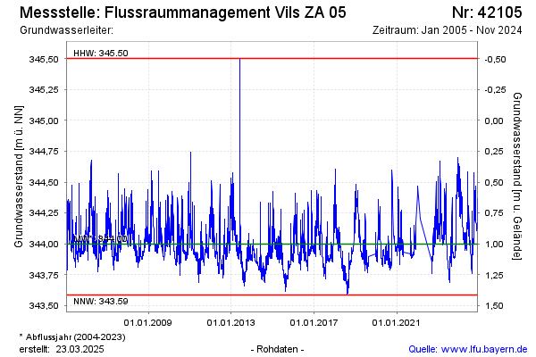
Groundwater level [m above sealevel]: 343.84
Distance to surface [m]: 1.16
Last value from 28.08.2025 08:45
Ground level [m above sealevel]: 345.00
| Date | Groundwater level [m above sealevel] |
|---|---|
| 28.08.2025 | 343.82 |
| 27.08.2025 | 343.81 |
| 26.08.2025 | 343.81 |
| 25.08.2025 | 343.82 |
| 24.08.2025 | 343.82 |
| 23.08.2025 | 343.83 |
| 22.08.2025 | 343.84 |
| 21.08.2025 | 343.83 |
© Bayerisches Landesamt für Umwelt 2025