
- Start >
- Groundwater >
- Waterlevel of upper layer >
- Bayern >
- Flussraummanagement Vils ZA 05 >
- Current data

Current data Flussraummanagement Vils ZA 05
Groundwater levels of the last 12 months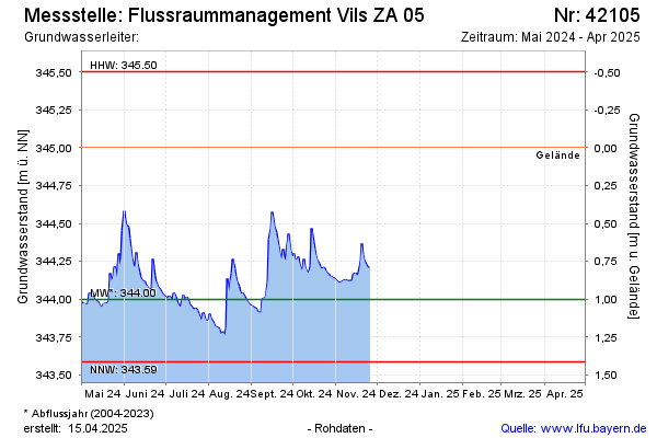
Groundwater level [m above sealevel]: 343.96
Distance to surface [m]: 1.04
Last value from 22.12.2025 09:50
Ground level [m above sealevel]: 345.00
| Date | Groundwater level [m above sealevel] |
|---|---|
| 22.12.2025 | 343.96 |
| 21.12.2025 | 343.96 |
| 20.12.2025 | 343.97 |
| 19.12.2025 | 343.97 |
| 18.12.2025 | 343.98 |
| 17.12.2025 | 343.99 |
| 16.12.2025 | 344.00 |
| 15.12.2025 | 344.01 |
© Bayerisches Landesamt für Umwelt 2026