
- Start >
- Groundwater >
- Waterlevel of upper layer >
- Bayern >
- Flussraummanagement Vils, MQS 11-R (MR11) >
- Chart of total period

Chart of total period Flussraummanagement Vils, MQS 11-R (MR11)
Groundwater levels of the total period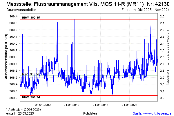
Groundwater level [m above sealevel]: 368.65
Distance to surface [m]: 2.75
Last value from 18.08.2025 09:50
Ground level [m above sealevel]: 371.40
| Date | Groundwater level [m above sealevel] |
|---|---|
| 18.08.2025 | 368.64 |
| 17.08.2025 | 368.62 |
| 16.08.2025 | 368.61 |
| 15.08.2025 | 368.58 |
| 14.08.2025 | 368.58 |
| 13.08.2025 | 368.59 |
| 12.08.2025 | 368.61 |
| 11.08.2025 | 368.63 |
© Bayerisches Landesamt für Umwelt 2025