
- Start >
- Groundwater >
- Waterlevel of upper layer >
- Bayern >
- Flussraummanagement Vils, MQS 11-R (MR11) >
- Year chart of precipitation

Year chart of precipitation Flussraummanagement Vils, MQS 11-R (MR11)
Groundwater levels of the last 12 months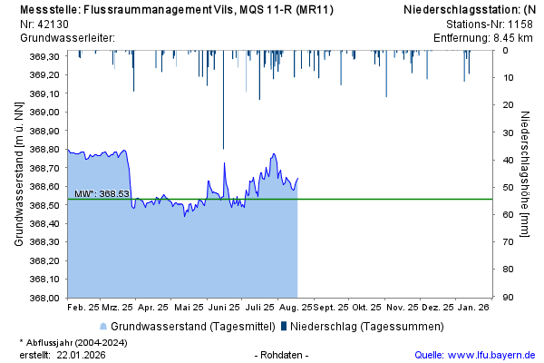
Groundwater level [m above sealevel]: 368,65
Distance to surface [m]: 2,75
Last value from 18.08.2025 09:50
Ground level [m above sealevel]: 371.40
© Bayerisches Landesamt für Umwelt 2025